
Community
Northern California Weather Shift Brings Rain, Strong Winds and Mountain Snow This Weekend
Two Pacific storms will bring rain, strong winds and mountain snow to Northern California November 13th through 16th. What North State residents should prepare for.
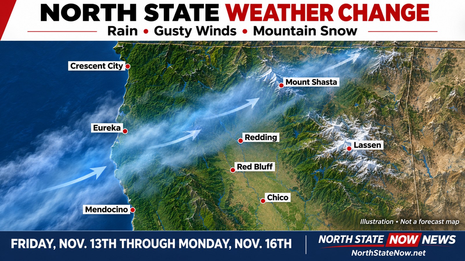
The North State's stretch of warm, dry weather is about to give way to a much wetter and windier weekend. For people in Redding, Red Bluff, Chico, the North Coast and mountain communities, now is the time to clear drains, secure outdoor belongings and take a closer look at travel plans.
National Weather Service forecasts issued Tuesday, November 10th, point to a series of Pacific storms beginning Friday, November 13th, and continuing through Monday, November 16th. Rain, strong south winds and mountain snow are all expected, with different concerns depending on where you live.
When the weather changes
Most inland areas should remain dry and unusually mild through Thursday, November 12th. Conditions begin changing along the North Coast late Thursday into early Friday, with rain spreading inland Friday.
The first round is expected to bring some of the most active weather Friday afternoon and night into Saturday. A second system follows late Saturday into Sunday and Monday. Some areas could get a relative break Saturday, but that should not be treated as a guaranteed dry window.
The incoming systems will draw on a plume of subtropical moisture over the Pacific. Forecast confidence is high that the overall pattern will turn wetter and cooler, while local rainfall totals and the timing of heavier bursts can still change.
Redding, Red Bluff, Anderson and Chico: wind is a major concern
A Wind Advisory is in effect from 4 a.m. to 7 p.m. Friday, November 13th, for the northern Sacramento Valley and portions of the central Sacramento Valley. Listed communities include Redding, Anderson, Red Bluff, Chico, Oroville, Gridley, Orland and Willows.
The advisory calls for south winds of 15 to 25 mph with gusts up to 45 mph. The strongest winds are expected Friday afternoon.
Those winds could bring down tree limbs, cause a few power outages and make driving difficult, particularly for trucks, trailers, RVs and other high profile vehicles.
For Shasta, Tehama, Butte and Glenn county residents, securing loose items before Friday and charging phones and backup batteries are practical steps to take now.
Rain will add another concern for drivers. Sacramento forecasters' Tuesday afternoon outlook placed general Valley and Delta rainfall around one third to two thirds of an inch Friday into Saturday, with 1 to 3 inches in mountain areas. These are broad regional estimates, not a guaranteed total for every community.
Localized heavier rain could overwhelm clogged drains and create ponding on roads. Isolated thunderstorms are also possible Friday afternoon and evening.
North Coast, Trinity, Mendocino and Lake counties: heavier rain and exposed roads
Northwest California is expected to see a more substantial soaking. The National Weather Service in Eureka projects a possible 3 to 6 inches of total precipitation in Del Norte County over the Friday through Sunday period, with generally lower amounts farther south and inland.
Its Tuesday discussion also placed the chance of at least an inch of rain between 4 a.m. Friday and 4 a.m. Saturday above 80 percent in Del Norte, Humboldt, northern and western Trinity, and northern Mendocino counties. Southeastern Trinity, southern Mendocino and Lake counties had a 65 to 85 percent chance of at least half an inch during that same period.
Wind exposure matters. Coastal headlands and higher terrain in Humboldt and Del Norte counties have a strong likelihood of gusts reaching at least 45 mph Friday, according to the Eureka forecast discussion.
For people traveling Highway 101, Highway 299 and other wooded or steep routes, watch for falling branches, downed trees, rockfalls and slides. Coastal residents should also monitor forecasts for high surf and tidal flooding around Humboldt Bay. Higher tides combined with strong south winds and large waves could affect low lying shoreline areas.
Siskiyou, Modoc and the northeast: wind first, changing snow levels later
The Medford weather office expects Friday's front to bring widespread rain and strong winds, with particular concern for the Shasta Valley and areas east of the Cascades. That includes exposed travel routes in the far northern interior.
Snow levels in that forecast area are expected to remain relatively high with the first front, around 6,000 to 7,000 feet Friday night. Another system arrives over the weekend, with lower snow levels and additional precipitation. The exact elevation and amount of snow will depend on location and how the systems develop.
Farther southeast, Reno forecasters identify northeast California as another area to watch for strong Friday winds. They also flag western Lassen and Plumas counties for locally heavier rain, with a 40 to 70 percent chance of at least an inch. Poor drainage areas could see localized flooding.
Do not assume conditions in Redding will match conditions near Mount Shasta, Susanville, Alturas or a mountain summit.
Lassen and the Sierra: prepare for winter driving
A Winter Storm Watch covers Lassen Volcanic National Park and portions of the northern Sierra above 6,000 feet from Friday morning, November 13th, through Monday afternoon, November 16th.
The watch calls for snow totals up to a foot, with up to 2 feet on the highest peaks, and wind gusts as high as 60 mph.
Snow levels are forecast to begin around 7,000 to 8,000 feet Friday, lower to about 6,500 feet Saturday, and approach 5,000 feet by Monday morning. Most measurable accumulation is expected above 6,000 feet, with only minor amounts possible lower down.
The heaviest snow is expected Friday night into Saturday morning, with another round possible Saturday night through Monday. Mountain travel could become very difficult. A watch means conditions are favorable for significant winter weather, so check for forecast changes before leaving.
What to do before Friday
Clear leaves and debris from gutters and accessible drains while conditions are dry. Secure patio furniture, trash cans, decorations and other items that could blow into roads or neighboring property.
Have flashlights, charged devices, needed medications and a plan for any equipment that depends on electricity. Bring pets indoors during rough weather and make sure outdoor animals have dry shelter.
Drivers should allow extra time, slow down on wet pavement and avoid driving through flooded roads. Mountain travelers should carry chains appropriate for their vehicle, warm clothing, food and water, and check current restrictions before departure. Never approach a downed power line.
Forecasts can change as the storms get closer. Check the forecast for your actual destination and elevation, along with Caltrans road conditions, before committing to weekend travel or outdoor plans.
To check your Northern California weather this next week...
https://northstatenow.net/weather/
Forecast information checked against National Weather Service Sacramento, Eureka, Medford and Reno updates issued November 10th, 2026. Rainfall, wind and snow forecasts remain subject to change.
Official forecast and travel resources: NWS Sacramento, NWS Eureka, NWS Medford, NWS Reno and Caltrans QuickMap.
Graphic: North State Now News illustration of Pacific moisture moving across Northern California. It is not a radar image or a forecast map.