
Community
Northern California Weather: What to expect this weekend and how Caltrans is preparing Highways for Storms as El Niño Strengthens
Caltrans District 2 crews are clearing sand traps, culverts and drains ahead of Northern California storms starting November 13th, as NOAA reports a strengthening El Niño.
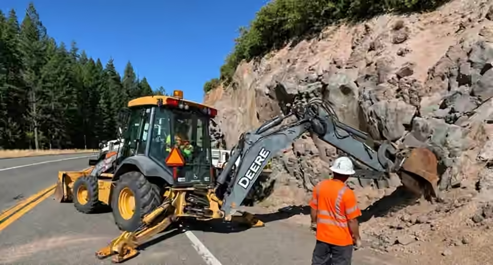
As Northern California braces for another round of wet and windy weather beginning Friday, November 13th, Caltrans District 2 crews are already working to reduce one of the problems that can make a rainstorm more dangerous: clogged highway drainage.
The agency says its stormwater crews have been cleaning sand traps throughout the district, clearing culverts and maintaining drainage systems ahead of the winter storm season. It is the kind of work drivers may barely notice on a dry day, but it can make a real difference when heavy rain begins moving across the North State.
The preparations come as the National Weather Service forecasts a series of storms for Northern California from Friday into early next week, bringing periods of rain, strong southerly winds, possible thunderstorms and mountain snow.
Why Caltrans is clearing sand traps before the storms
Sand traps collect sediment, dirt and debris before that material can reach larger drainage systems. When they fill up, stormwater may have fewer places to flow, increasing the risk of standing water and localized flooding along roadways.
Caltrans District 2 says crews are working across the district to remove accumulated material and keep water moving. That includes clearing culverts and other drainage infrastructure before storms place additional demands on the system.
For communities that depend on mountain highways and rural roads, drainage maintenance is especially important where runoff can carry rocks, soil and debris toward the pavement.
What Northern California can expect beginning Friday
In its early morning forecast discussion on Thursday, November 12th, the National Weather Service in Sacramento said the first system will bring increasing rain Friday, with the possibility of thunderstorms developing during the afternoon and evening.
Forecasters estimate approximately a quarter-inch to one inch of rain in Sacramento Valley locations during the first system, with amounts up to two inches in the mountains and foothills. Locally heavier amounts are possible where stronger storms develop. Thunderstorms could also produce brief heavy rainfall, lightning, gusty winds and small hail.
A Wind Advisory is scheduled for 4 a.m. to 7 p.m. Friday in parts of the northern and central Sacramento Valley, including the Shasta area and portions of Tehama, Glenn and Butte counties. Gusts could reach 45 mph in the advisory area.
Higher elevations face a different hazard. Heavy mountain snow and strong winds could make travel difficult, particularly around Lassen National Park and the northern Sierra. Additional precipitation is forecast from a second system arriving over the weekend and continuing into Monday.
Residents and travelers in Redding, Anderson, Red Bluff, Chico and surrounding North State communities should watch for changing conditions, water collecting on roads and possible downed branches.
Northern California El Niño outlook strengthens
The timing of the storms also comes amid a significant development in the broader winter outlook.
On November 12th, NOAA's Climate Prediction Center reported that El Niño continues to intensify. Its latest outlook gives a greater than 79 percent chance of a strong to very strong El Niño continuing through the January to March 2027 period.
El Niño refers to an ocean and atmosphere climate pattern centered in the tropical Pacific. It can influence winter weather across California and the United States, although its effects vary by location and season.
That distinction matters: an active El Niño does not mean every Northern California storm is directly caused by El Niño, and it does not guarantee flooding or above-average rainfall in every North State community. Individual storm forecasts still provide the best guidance for what to expect over the next several days.
A few steps to take before the rain arrives
While Caltrans works on public drainage systems, residents can take similar precautions at home. Keep gutters and accessible drainage paths clear of leaves and debris, secure loose outdoor objects before Friday's winds, and avoid driving through standing or moving floodwater.
Anyone traveling on Interstate 5, Highway 299, Highway 44 or other mountain routes should check current road conditions, especially as snow levels and winds change. Drivers should never attempt to clear debris from an active roadway themselves.
The bigger message behind the Caltrans work is simple: storm preparation begins before the first raindrops fall. With wet weather approaching and El Niño strengthening, those routine drainage projects are getting a timely reminder of why they matter.
For the latest Northern California weather information, visit the North State Now weather page.
Sources: Caltrans District 2 stormwater maintenance update provided November 12th, 2026; National Weather Service Sacramento area forecast discussion, November 12th; NOAA Climate Prediction Center El Niño diagnostic discussion, November 12th.